For over a year now Andy Ashton and I have been talking about running the Welsh 3000s: a challenge that takes in all 15 peaks in Wales over 3000ft. The entire route is around 30 miles including walk in and out but times are clocked from first to last peak. Walkers attempt to do this in under 24hrs. The record is 4hrs20mins. We were hoping for somewhere in-between, with the goal being to have a great day out in the hills rather than achieve the fastest time possible.
After reading up on possible route choices we decided to set out from Pen-y-Pass and do Crib Goch as our first peak. Purists will want to start on Yr Wyddfa but starting on Crib Goch makes for a superb route as you cut out the roads completely and you get to start the day by traversing Crib Goch's airy ridge rather than slogging up the Miner's Track.
On the evening before the run we drove up the valley to look at where we would drop off the hillside. The descent from Snowdon is all off-track and there are quite a few crags that you wouldn't want to run off so we wanted to get a feel for where we'd be going. This was well worth doing. Once we thought we had the route planned we headed to the Vaynol Arms for three pints of Dragon Ale before turning in for the night.
Snowdon
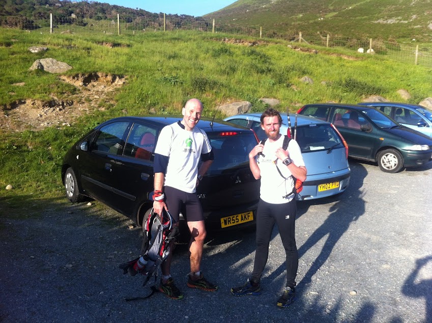
We arrived at Pen-y-Pass car park at 7am expecting to find it empty but were surprised to find only a handful of spaces left. Not as surprised as the fees for parking though and the phrase "Did you really say TEN QUID?" became a repeated joke throughout the day.
Pen y pass - Crib Goch
 |
| The start of the adventure: leaving Pen y pass |
It was chilly but not too cold as we made our way up the hill. We passed a few groups of walkers all out for an early start. It started to drizzle as we reached the turn off for Crib Goch so away went the poles and out came the waterproof tops. The scramble up was great fun but the rock was slippery and numbingly cold and the temperature dropped the higher we climbed. As we reached the ridge it actually started to snow...in June!
 |
| Scrambling up to Grib Goch |
 |
On the Crib Goch ridge. The red ridge in the background
is the descent you would take if starting on Yr Wyddfa |
 |
| Crib Goch ridge. The summit is the peak with the Quartz band. |
 |
On the summit of Crib Goch: peak #1 with
Yr Wyddfa in the background |
Carnedd Ugain
We dropped down from the summit of Crib Goch and easily traversed the first pinnacle. The second pinacle was a little trickier. There is a good line down to the left but this could be difficult to spot in poor visibility and straying from it would be dangerous. I should point out that Andy and I are both climbers and each have a reasonable head for heights.
 |
Scrambling down to pass the second pinacle.
The line of the "path" traverses around the
ledge which is under the lake in this picture. |
 |
| At the and of the traverse around the Second Pinacle |
At the end of the ridge we met two runners doing the 3000s in the opposite direction. We had a brief chat and wished each other good luck before we each headed off into the clag. The clouds had quickly rolled in and it went from perfect to very poor visibility in a short space of time. Andy led the way on a path to the left of the ridge but we didn't seem to be gaining much height. Unsure about whether this path would actually take us to the summit we decided to scramble up a very loose gully. This was pretty unpleasant work. We couldn't see how far away from the top we were and the climb seemed to go on for ages (though probably because we were sliding back one step for each three forward). When we reached the skyline we realised that we were still a long way from the summit. We climbed the ridge and eventually a path (presumable the one we were on) joined us from the left.
 |
| Carnedd Ugain: Peak #2 |
Yr Wyddfa (Snowdon)
We couldn't see much here but the route from Carnedd Ugain to Yr Wyddfa (the main summit of Snowdon) is very straightforward and for the first time in the day we actually started running! We climbed past the heaps of litter to reach the summit tower and chatted with a couple of friendly walkers about the views that we couldn't see.
 |
| The top of Snowdon. Wish you were here, Dave! |
Nant Peris
We had both been a little apprehensive about this descent as we'd basically have to pick our own way down the hill and it looked pretty steep from the valley but after the exhilarating start to the day we were now really looking forward to exploring new ground.
We followed the Llanberis path, dropping down out of the clouds, until we came to where the path goes through the tunnel under the railway line. At that point we left the path and ran next to the railway line.
 |
| Dropping out of the clouds on the Llanberis path |
 |
Pleasant running next to the railway line. Our descent point
was mid-way along the grassy ridge beyond the large crag. |
The second train of the day steamed past us at close quarters, rammed full of tourists taking the easy route to the top. When the train line pealed away to the left we continued running along the ridge until we came to a stile. We crossed the stile and worked our way steeply down to a faint path. The grass was very slippery and we each ended up on our backsides several times before the angle eased.
After a few stops to consider various options we arrived at the wall that crosses the hill at exactly the point where it meats a small drop off. In dry conditions this little cliff could easily be down climbed but I tested it out and it was pretty dangerous today. A fall wasn't going to kill but could well break bones. We worked our way to the right and had to do some comedy 8ft jumps down onto sloping wet grass holding onto tufts of grass to arrest the fall. We made it and worked our way gently down to the stile that would take us onto a footpath across a footbridge and into Nant Peris.
I am lucky enough to have access to a cottage that is on the Welsh 3000s route and so we stopped in at Pant-y-Fron to swap over kit. We were both soaked from rain and sweat but the sun was coming out so I took the opportunity to change into shorts and pack away my base layer. We stocked up on water, food and copious amounts of Coke then it was off to re-gain all the height we had just lost..
 |
| Pant-y-Fron: Base Camp |
Glyderau
Elidir Fawr
I have climbed Elidir Fawr many times, almost always in really crappy weather so my memories of this climb were rather negative but be both loved it. The poles were doing their stuff, really taking the pressure off the legs, the temperature was about right and behind us we had stunning views of Snowdon. It was really strange to think that we'd been standing up there just an hour ago.
 |
Looking back to Snowdon on the climb
up Elidir Fawr |
The time seemed to pass very quickly and we passed a few groups of walkers as we chatted our way up the hill. Just before we reached the summit we broke into the sunshine and as we crested the top we were met with beautiful views north to Anglesey.
 |
| Andy taking in the views from peak #3: Elidir Fawr |
Y Garn
We loitered for a good few minutes on the summit, taking in the views, snapping a few photos, putting on base layers (it was sunny but the gentle breeze was bitterly cold) and generally just enjoying being there. We could see two runners on the edge of the bowl ahead and wondered if it was the two lads we'd met on Crib Goch. Suppose we'd better get moving too!
 |
Good running on the descent from Elidir Fawr
with Snowdon in the background |
The run around the bowl was great. Lovely undulating single track and we made the most of it while it lasted.
 |
The Alps? Nope, we're still in Wales.
The descent gully from Tryfan can clearly be seen
as a grey diagonal line directly to the left of the summit |
 |
| The summit of Y Garn |
We got the poles out for the climb up Y Garn and once again they worked superbly on this good quality trail. The views were absolutely stunning. If we looked right we could see Snowdon and were we had been so far. If we looked left we could see the Carnedds and look at where we'd be heading in a few hours time.
 |
| Y Garn: peak #5, with Tryfan and Glyder Fach behind |
Glyder Fawr
I really enjoyed the descent from Y Garn. It was rocky but a good angle to run quite hard without trashing the quads. We passed quite a few groups on the descent and loads of people sunning themselves by the lake then it was out with the poles again to climb Glyder Fach.
So far we had been really enjoying the climbs, getting into a great rhythm with the poles, but this climb was up rocky gullies which stopped you getting into any sort of regular pace. The poles were still beneficial but it was harder work that the previous climbs.
We reached the rocky summit and interrupted a bloke's dinner to ask him to take a photo of us. To me reaching Glyder Fawr felt like a significant point in the day, though I'm not sure why.
 |
| On Glyder Fawr: Peak #6 |
Glyder Fach
Initially the run across the summit plateau looked completely un-runnable but once we got going we managed to jog across the boulders. We got a shout from a walker "You guys are completely MAD" which made me laugh.
 |
The rocky summit plateau of Glyder Fawr with Glyder Fach ahead.
Flat ground but how fast can you run on this? |
 |
Approaching Glyder Fach. The rocky peak which looks like the
summit is Castell y Gwynt, which is not on the route.
Glyder Fach is the lump to the left. |
 |
| The final scramble to the summit |
 |
| Peak #7: Glyder Fach |
Tryfan
With the Glyders in the bag we turned towards Tryfan. To get there we ran over towards the groups of people at the top of Bristly Ridge then took the gully immediately to it's right. This slopes gradually down then steepens dramatically.
 |
| The top of the descent gully |
 |
| In the gully |
This would be a great gully to run if you had it to yourself but we had several groups of walkers beneath us, gingerly edging their way down. With every foot fall there was risk of dislodging large rocks down onto those below so great care was needed. It was great to get through them and relax into some fun, steep running. Once at the bottom we ran across to the pleasant scramble up the South face of Tryfan.
 |
| The South face of Tryfan |
 |
| Peak #8: Tryfan. Standing room only! |
As we approached the summit we were surprised to meet the two lads we'd passed on Crib Goch. They were choosing to reverse the longer route back to Bwlch Tryfan rather than the steeper West Gully because their legs were tiring. It was nice to see them again and once again we wished each other good luck and went our way.
 |
| Looking to Llyn Ogwyn from the top of the West Gully |
From the top of the West Gully we could see the tiny toy cars down by Llyn Ogwyn. This was exciting for us because support was waiting in the form of fellow Delamere Spartan John Kleiser who would be waiting with supplies and joining us for the final section over the Carnedds.
We worked slowly down the gully (marvelling at how the record holder reached Llyn Ogwyn from the summit of Tryfan in 8mins!) before running the thigh-burning descent on the steps from hell. Once we were low enough we traversed the bogs under the crags to join the main path to the YHA.
Ogwyn
We quickly realised that finding John was going to be a problem. Cars were parked as far as the eye could see in either direction and John had no phone reception. We ran around for ten minutes before we found him then we sat down for 15 mins while we enjoyed the luxury or fresh sandwiches, crisps and refills of water and Coke.
Carneddau
Pen yr Ole Wen
And so two become three! The climb from the YHA up Pen yr Ole Wen is an honest climb! Steep, relentless, but it will get you up to the top with no messing about. In hindsight we decided it would be quicker to stay away from the YHA, passing Llyn Ogwyn on the south. Still, we enjoyed the climb even when I managed to take us off the main route for several hundred meters.
 |
| John Kleiser enjoying the climb out of the valley. |
 |
| Looking back to Tryfan |
When we reached the top we found our two mates summitting from the other side. It was great to hear that they were enjoying the route just as much as we were. At this point all the major climbs are behind you and the finish starts to feel close.
 |
| Our fellow runners |
 |
| Me, John and Andy on Pen yr Ole Wen: peak #9 |
Carnedd Dafydd
From Pen yr Ole Wen we enjoyed beautiful running around the bowl, with stunning views out to Anglesey and the Menai Straights.
 |
| Climbing to Carnedd Dafydd |
As we reached the summit of Carnedd Dafydd we were met with views of the rest of the route. The end was tantalisingly close but we were still enjoying it so much that we didn't want it to end and we were still feeling pretty fresh!
 |
Looking across to Carnedd Llewelyn (in shaddow on the right),
the traverse out to Yr Elen on the left and in-between Foel Grach
(right) and Foel-fras in the sunshine |
Yr Elen
 |
Traversing around Carnedd Llewelyn. The ridge on the skyline
is the route we have just run from Carnedd Dafydd |
 |
The and of the traverse, ready to head over to Yr Elen
(the peak on the right) |
 |
| On Yr Elen (peak #11) with the final two peaks behind |
 |
| Very happy Spartans! |
Carnedd Llewelyn
It's a great feeling to turn back towards Carnedd Llewelyn knowing that once you get there you are on undulating ground right to the finish. We passed the other team then broke out the poles for the last time as we started the last significant climb of the day.
 |
| Carnedd Llewelyn: peak #12 |
Foel Grach
I managed to not take any photos on this section but it was quite unremarkable. Rocky ground slowed the pace and boggy streams made the feet wet.
Garnedd Uchaf
 |
| Almost over! The final two peaks: Garnedd Uchaf is the small pile of stones on the left, Foel-fras is the hill on the right |
 |
| On Garnedd Uchaf: peak #14 |
Foel-fras
The nice, gentle climb leads up to the final summit of Foel-fras is very runnable. It levels off into a rocky summit plateau and the trig point seems to take forever to come into view. And then there it is, peak number 15, around 10hrs 15mins after leaving Crib Goch.
I have heard that Foel-fras can seem like a poor place to finish the 15 peaks but today we could see over the ocean to the Isle of Man and it was breathtaking. We sat around, eating, chatting and taking in the views. For John, who is an experienced hill walker and peak bagger, this was the first time he had run in the mountains and it was was his biggest run so far this year so we could all bask in a sense of achievement. Just as we were starting to get cold and thinking about moving on our two buddies appeared on the crest of the hill. It was nice to be able to clap them in.
Descent
So the run is over, but we are still six miles from the car, which was parked in the higher car park above Abergwyngregyn. With tired quads we walked the steep descent to the lake then couds of midges forced us to get running again! We jogged around the lake shore to join the good track that took us right back to the car.
Andy and I had planned this as a training run but you can't call a day like this a training run; this is what it's all about! What a fantastic day. This is a superb day out for anyone with experience of the mountains and a head for exposure. I already can't wait to go back and go for a good time. I think 8hrs 30mins would be very doable.
Thanks to Andy for the company. We didn't get fed up with each other after 13hrs of running but surely we must run out of things to talk about soon?? Huge thanks to John not only for the good company and route knowledge but also for providing the amazing support stop.